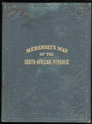
South African Republic (Folding Map)
ORIGINAL MAP OF THE TRANSVAAL OR SOUTH-AFRICAN REPUBLIC INCLUDING THE GOLD AND DIAMONDFIELDS, 1875
Printed on paper and coloured in outline, 510 x 510 mm, folds into blind stamped green cloth covers titled gilt, stained across the first fold and along the bottom edge, minor tears at some folds.
R20,000