
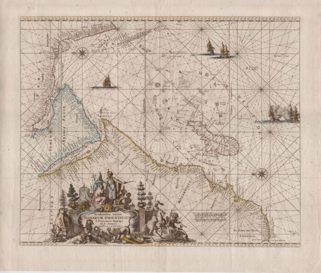
Ottens (R & J)
Occidentalior Tractus Indiarum Orientalium['The western extension of the East Indies', i.e.
a Promontrio Bonae Spei ad C. C. Comorin [from the Cape of Good Hope to Cape Comorin]
Published: Amsterdam, c. 1740
Stock Number: #10323
Price: R17,000
Approximately:
44.0cm x 53.9 cm. Beautiful, decorative sea chart of the western part of the Indian Ocean and adjacent land. Published by the Ottens brothers in Atlas de la Navigation et du Commerce in 1739 and 1745.
The map first was published by Frederick de Wit in 1680 and the Atlas first was published in 1715 by Louis Renard - the original copper plates having then been acquired by the prolific Ottens brothers. A beautiful, well-engraved and important portolan chart of the western Indian Ocean with detail of Madagascar and the other islands.